
|
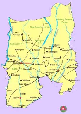
General Description Kokrajhar, one of the 35 districts of
Demographic Profile The
total population of the district is 8,87,142 as per 2011 census, of which
8,32,201 (93.81%) live in rural areas. The population density per square
kilometre is 280 with sex ratio of 958 per 1000 males. Population of male
is 51.05% and female is 48.95%. The SC and ST population constitute 34.74%
of the total population of the district. The literacy rate of the district
is 66.63%. Demography of Kokrajhar
and
Agriculture in Kokrajhar Agriculture is the main occupation
of Kokrajhar district and contributes a major part
in the district economy. The average size of operational land holdings in the
district is 1.20 ha. Rice is the main crop which covers about 80% of the
Gross Cropped Area. The Gross Cropped Area of the district is 1,77,394 ha as against the Net Cropped Area of 1,08,167 ha
with a cropping intensity of 164.20%. In the district, double cropping is a
regular practice in major parts of the cultivable land and triple cropping is
also undertaken in certain pockets having assured irrigation facility. The
major field crops grown in the district are Ahu
paddy, Sali paddy, Jute, Mesta,
Black gram, Sesamum during Kharif
season and Boro paddy, Wheat, Toria,
Niger, Linseed, Lentil, Buckwheat, during Rabi season. Sali
paddy is distributed throughout the district under rainfed
condition. Under horticultural crops both Kharif
and Rabi vegetables, fruit trees namely Banana, Pineapple, Citrus, Jackfruit
etc., Chilli, Ginger, Turmeric, Black pepper as
spices, Tuber crops like Potato, Tapioca, Colocasia
and Plantation crops viz. Areca nut, Coconut etc. are commonly cultivated in
the district. In case of fishes, different indigenous and exotic breeds like Catla, Rahu, Mrigal, Calbasu, Bato, Bhangan, Puthi, Borali, Chitol, Kandhuli, Silgharia, Prawn
etc. are grown. In Animal Husbandry sector, different indigenous and cross
bred are reared by the farmers of the Kokrajhar
district. Area, Production and Productivity of
major crops
Topography and Agro-climatic characteristics The district has
a total area of 3169.22 Km2. Till recently the district had over
50% of its geographical area covered by deep green forest. But the forest coverage
has dwindled substantially due to unscrupulous and massive denudation. Most
of the terrain in the district is scantily populated and thickly forested.
The district is characterised by almost plain topography being flanked by
foothills of
Agro-climatically, the district
falls under Lower Brahmaputra Valley Zone of Assam.
The climate of the district is humid sub-tropical in nature
characterized by warm-humid summer and cool-dry winter. The average annual
rainfall of the district is 3127 mm against the state average of 2584.50 mm
and the mean maximum and minimum temperature varies from 33-38°C and 8-10°C
respectively. The soil texture is mostly sandy loam to clay loam with PH
ranging from 4.7 to 7.8 i.e. acidic to neutral. The district has been divided into three Agro Ecological
situations (AES) based on physiography, hydrology,
soil, climate and cropping patterns. Agro-Ecological Situation of Kokrajhar district
The existing farming systems prevalent
in various AES
Land
use pattern and land holdings The
total geographical area of the district is 3,98,635 ha and out of which,
38.05 % is cultivable, 0.7% cultivable wasteland, 0.9% current fellow, 54.94%
forest, 5.78% Pasture, 9.1 % under non-agricultural use, 1.75 % under miscellaneous
plantation The Net Sown Area of Kokrajhar district
is 89,784 ha which is 28.33% of the total area of the district. There are
55,908 operational holdings and the average size of land holding is 1.20 ha.
The marginal farmers constitute 40.77% of farm families with 17.91% of land
under their possession and the small farmer is 33.39% occupying 30.54% of
land. 19.52% of farm families represent semi-medium farmers possessing 31.99%
of land while medium farmers constitute 6.27% of farm families with 19.07% of
land. The large farmer in the district is only less than 1% of total farm
families. |
|||||||||||||||||||||||||||||||||||||||||||||||||||||||||||||||||||||||||||||||||||||||||||||||||||||||||||||||||||||||||||||||||||||||||||||||||||||||||||||||||||||||||||||||||||||||||||||||||||||||||||||||||||||||||||||||||||||
 |
|  |
|  |
| 
 Krishi Vigyan Kendra, AAU, Kokrajhar.